
These images are based with permission on 1:10,000 Trench Map 57dNE3&4-4b (17/02/17) Hebuterne from The Imperial War Museum Trench Map Archive CD-ROM published by The Naval & Military Press. British and German trenches are shown in blue and red, respectively. 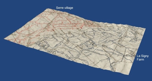
"The [British] front line really ran along the bottom of a trough. I was familiar with the position in 1916, and I have seen it since the war....Our support and reserve trenches were on a very definitely forward slope, and were under enemy observation." (Capt. Francis Geoffrey Macalpine M.C., 11th Bn., East Lancashire Regt., writing in 1930.) 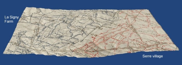
The 3D images were made with the help of an article written by Howard Anderson, which was previously available through the website of The Western Front Association. Francis Macalpine's quotation was taken from TNA document CAB45/190.
|